
ORDU, Turkey — In an era where global food security faces unprecedented challenges from climate change, population growth, and shifting economic landscapes, two visionary high school students from the Black Sea province of Ordu have developed a groundbreaking technological solution designed to bring scientific precision to traditional farming.
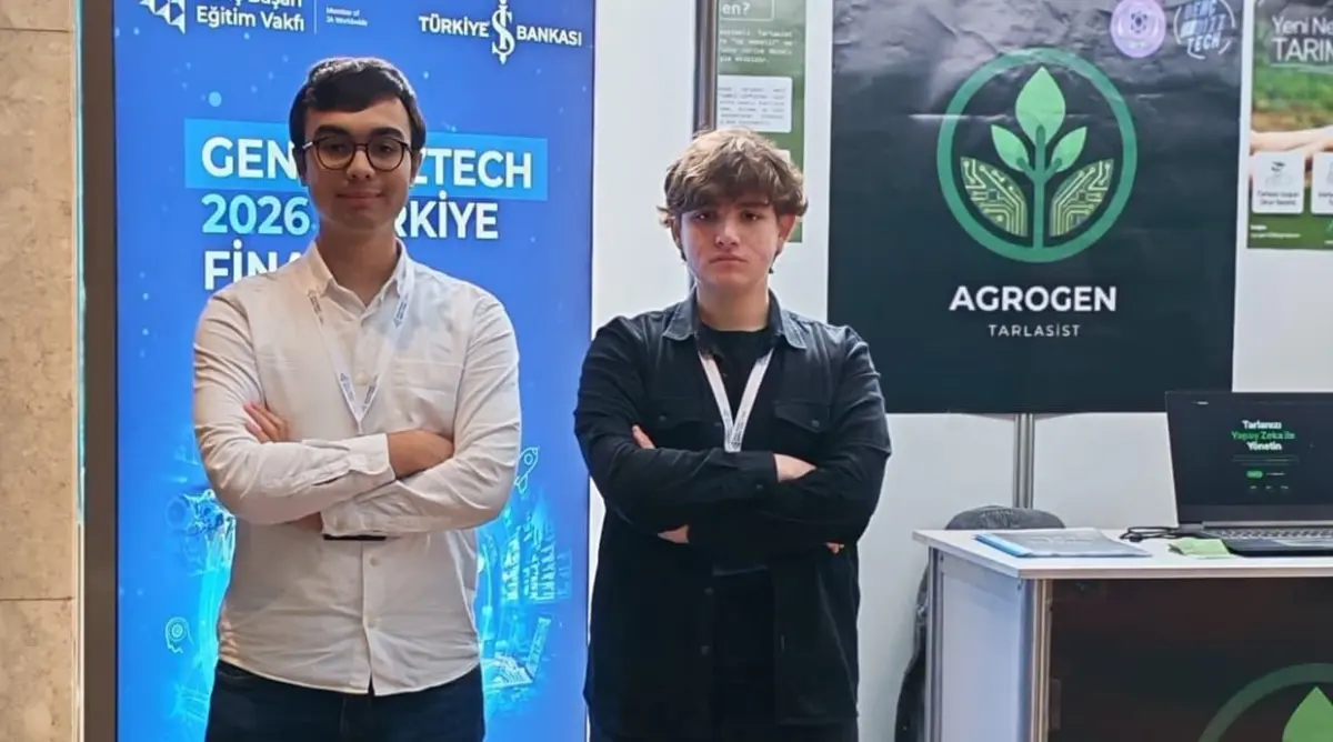
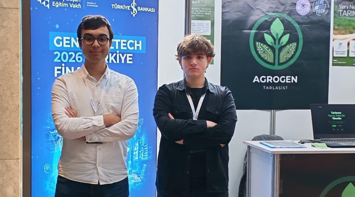
Muhammed Ensar Aktaş, an 11th-grade student, and Alper Hamza Altıntaş, a 12th-grade student at the prestigious Ordu Science High School (Ordu Fen Lisesi), have successfully created "Tarlasist," an artificial intelligence-backed mobile application. Operating under the name "Agrogen Team" and guided by their advising computer science teacher, Hamdi Uğur Taş, the young innovators designed the system to analyze agricultural land, determine optimal crop types based on geographic and soil data, estimate potential yields, and generate comprehensive profit-and-loss financial statements for farmers.
The project has already garnered significant national acclaim. Competing in the GençBizzTech 2026 program—a highly competitive entrepreneurship and technology initiative conducted through a strategic partnership between the Junior Achievement Education Foundation (Genç Başarı Eğitim Vakfı) and Türkiye İş Bankası—the Agrogen Team secured an impressive third-place finish out of 472 participating teams from across Turkey.
Meeting the Global Demand for Increased Agricultural Yields
The inspiration behind Tarlasist stems from a critical global challenge. The United Nations Food and Agriculture Organization (FAO) published a landmark study projecting that the global population will exceed 9 billion people by the year 2050. To meet the nutritional needs of this rapidly expanding population, global agricultural production must increase by an estimated 70% over current levels.
For Muhammed Ensar Aktaş, this statistic served as a call to action. Turkey possesses highly fertile soil and occupies a uniquely advantageous geographical position for diverse agricultural endeavors. However, despite these natural benefits, a significant portion of the country’s farming community continues to rely on traditional, ancestral methods that are increasingly out of sync with modern environmental realities.
"Scientific data is becoming the most critical asset in modern industries, yet agricultural practices in many regions remain largely traditional," Aktaş explained. "Farming methods that do not rely on scientific data are gradually losing their viability and efficiency. We focused our efforts on solving this specific problem. With the application we developed, we aim to provide farmers with direct, accessible scientific support to help them select the right crops and maximize their yields."
Recognizing that many traditional farmers may not be highly tech-savvy, the Agrogen Team placed user accessibility at the core of their design process. "When designing the application, we kept in mind that digital literacy among our target demographic of farmers can sometimes be low," Aktaş added. "Therefore, we focused on creating an interface that is as simple, clean, and intuitive as possible."
Evaluating Suitability for 90 Different Crops
The core functionality of Tarlasist begins the moment a farmer opens the application on their smartphone. The system offers multiple, highly flexible ways to identify and select a specific plot of land. Farmers can choose to manually mark their fields on an interactive map, or they can utilize the app’s integration with the database of Turkey’s General Directorate of Land Registry and Cadastre (Tapu ve Kadastro Genel Müdürlüğü) to input official address and parcel information. Alternatively, if the farmer is standing directly on their land, the application can automatically pinpoint the exact location using the smartphone’s built-in GPS capabilities.

Once the boundaries of the field are established, the user simply taps the "Analyze" button. Tarlasist instantly connects to multiple regional and global databases to retrieve historical and real-time environmental data. The system then evaluates the land’s compatibility with 90 different types of agricultural crops, ranking them according to their likelihood of success.
Importantly, Tarlasist does not stop at crop recommendations. The application functions as a comprehensive financial advisor for the farm. It automatically calculates the projected operational expenses associated with the recommended crops, factoring in current local costs for essential inputs such as diesel fuel, fertilizer, pesticides, and manual labor.
After calculating these input costs, the AI model estimates the projected harvest volume based on historical soil productivity and regional climate data. Finally, it processes this information to present the farmer with a clear, reliable post-harvest income-and-expense table, outlining the estimated net profit margin. This allows farmers to make data-driven decisions before purchasing seeds or preparing their soil.
Utilizing Satellite Imagery and NDVI Technology to Measure Soil Health
While regional climates provide a general baseline, soil conditions can vary dramatically even between neighboring plots of land. To address this localized variability without requiring farmers to purchase expensive physical testing equipment, Tarlasist leverages advanced satellite technology.

The application integrates Normalized Difference Vegetation Index (NDVI) data, which uses satellite imagery to measure the density, greenness, and overall health of vegetation on a specific plot of land. By analyzing historical NDVI values over a rolling 12-to-24-month period, the AI model gains a deep understanding of the land’s recent productivity cycles and current soil vitality.
This satellite-driven analysis also serves as a crucial safety net. If the historical NDVI values for a selected plot of land fall significantly below the expected baseline
, the system automatically flags the area as an "anomaly."
According to the developers, such anomalies are frequently the result of disruptive environmental events or poor land management practices, such as recent stubble burning (anız yakımı), sediment accumulation following a flood, or severe overgrazing. When Tarlasist detects an anomaly of this nature, it proactively halts its recommendation engine and advises the farmer against planting new crops until the soil has had sufficient time to recover, preventing costly agricultural failures.

Voice Commands Bridge the Digital Divide for Older Farmers
To ensure that the power of artificial intelligence is accessible to all generations of agricultural workers, the Agrogen Team implemented a highly sophisticated voice command feature. Alper Hamza Altıntaş, a 12th-grade student and co-developer of the app, highlighted how this feature transforms the user experience for individuals who might find navigating a standard mobile interface challenging.
"Because our primary target audience includes older farmers who may have limited experience with modern smartphones, we integrated a voice command system," Altıntaş explained. "By simply pressing a prominent microphone button on the screen, the user can say, ‘Analyze my field.’ The voice assistant then speaks to the farmer in a conversational, friendly manner—almost like a trusted neighbor or a helpful friend."
The voice assistant guides the user through the necessary steps, performs the complex backend calculations, and reads out the results, crop recommendations, and financial projections in clear, spoken language.
Altıntaş also noted that the benefits of the application extend beyond individual farm gates. "When a farmer achieves high yields and optimized production costs through our app, those savings and efficiencies are naturally reflected in the final market prices of the produce. Ultimately, this creates a win-win scenario that benefits the end consumer as well."
While similar agricultural analysis platforms exist internationally, they are often prohibitively expensive and highly complex, requiring farmers to purchase and install specialized physical sensors across their fields. Tarlasist completely bypasses these barriers.
"Our application requires absolutely no additional hardware or sensors; a standard smartphone is all that is needed," Altıntaş said. "We plan to offer both free and premium subscription models. The basic analytical features will be accessible to everyone free of charge, while advanced features, such as the conversational voice assistant, will be available under a reasonably priced premium tier."
The application is currently fully functional and undergoing rigorous beta testing to further refine its predictive models and user experience. The Agrogen Team plans to officially launch Tarlasist on major mobile app stores in the coming year, making it widely available to the public.
Supporting Strategic Agricultural Decision-Making
Hamdi Uğur Taş, the advising teacher who has guided the students throughout their intensive development process, emphasized the profound practical value the application holds for regional economies, particularly in the Black Sea region where traditional farming is deeply rooted.
"In regions like the Black Sea, where agricultural practices have been passed down through generations without much change, an application like Tarlasist will make a massive difference," Taş observed. "For instance, during seasons when hazelnut yields are low or market prices are unfavorable, local farmers frequently struggle to decide what alternative crops they should plant to sustain their livelihoods."
By replacing guesswork with hard science, the application acts as a stabilizing force for rural economies. "The students’ work will provide an invaluable decision-making tool for these communities," Taş concluded. "The application speaks the language of science, translating complex satellite data and financial metrics into clear, actionable guidance. This is incredibly valuable for the future of sustainable agriculture."